GPS Converters & Utilities
Multi-format conversion (GPX, KMZ, KML, OV2, WPT/TRK, GPI), 3D Global Terrain, and World POI Database.
Current SectionAtmospheric Activity
Detection and monitoring of meteorological anomalies and lightning activity up to 1,000 Km.
Access SectionFalcon 9 Simulator
Real-time first-stage simulator based on engineering equations and 3D OpenGL visualization.
Access SectionGPS & Geospatial Catalog
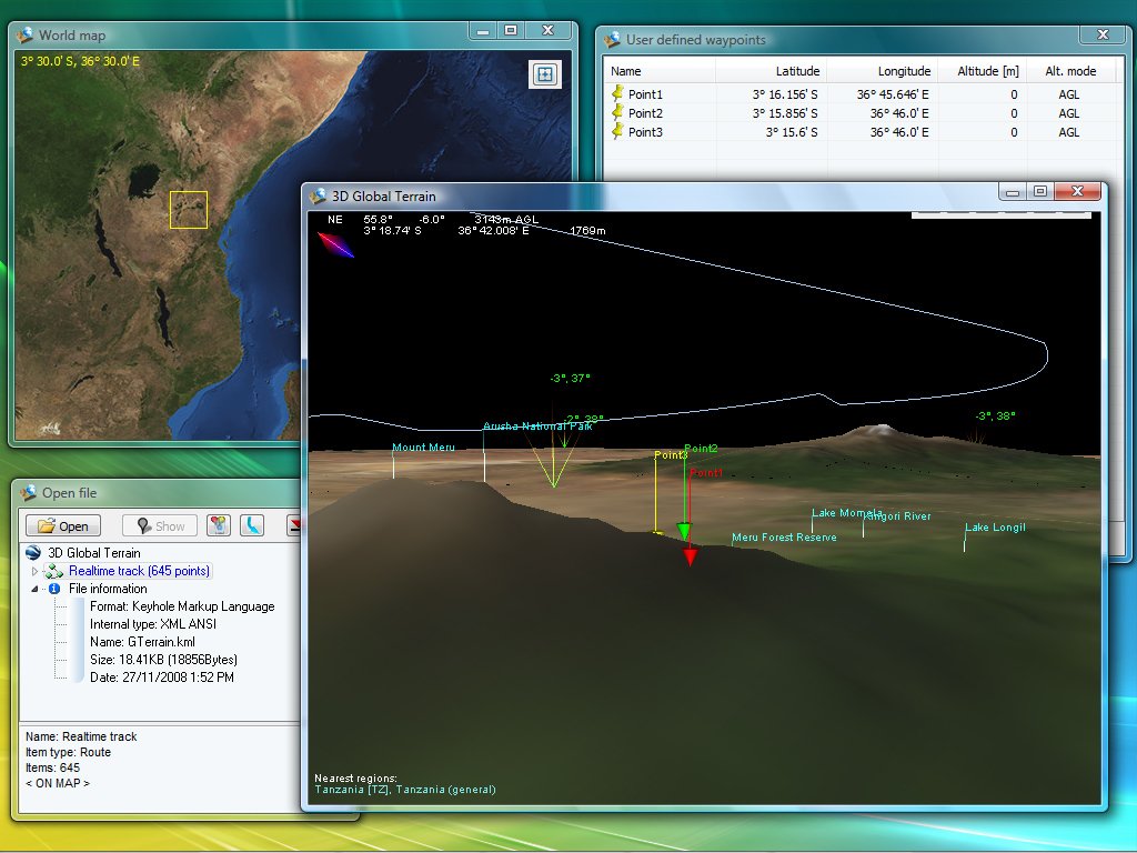
3D Global Terrain
Global topography & imagery (offline 3D platform). An off-line 3D platform combining NASA Blue Marble imagery, SRTM elevation data, and millions of land markers (cities + POIs). Load and visualize Waypoints, Routes, and Tracks from multiple formats.


GPS Converter
Multi-format converter. Convert Waypoints, Tracks, and Routes between many GPS and mapping formats. Includes powerful tools to manipulate data and convert between data types (e.g., track → waypoints, waypoints → route).
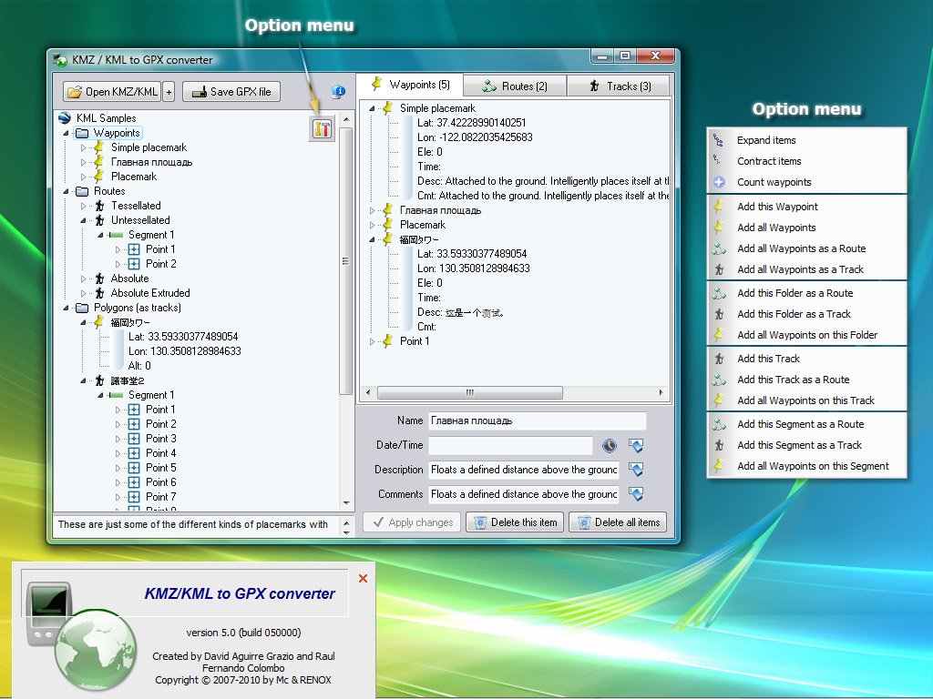
KMZ/KML ↔ GPX converters
GE2GPX & GPX2GE. Two tools to transfer Waypoints/Routes/Tracks between Google Earth (KMZ/KML) and GPS Exchange Format (GPX). Use GE2GPX to go from KMZ/KML → GPX, and GPX2GE for GPX → KMZ/KML.

World POI DatabaseFREE
12,026,386 places (offline). A very large off-line database (countries, cities, and POIs). Search by keyword, inspect detailed location data (ISO codes, coordinates, flags), and export waypoints to KML. Raw CSV dataset available on request.

Ov22Gps
TomTom OV2 → KMZ/GPX. Convert TomTom Navigator overlays (OV2) into KMZ or GPX in a few steps.

Ge2Ov2
KMZ/KML → TomTom OV2. Convert Waypoints, Routes, and Tracks from KMZ/KML into TomTom Navigator overlay (OV2) files.

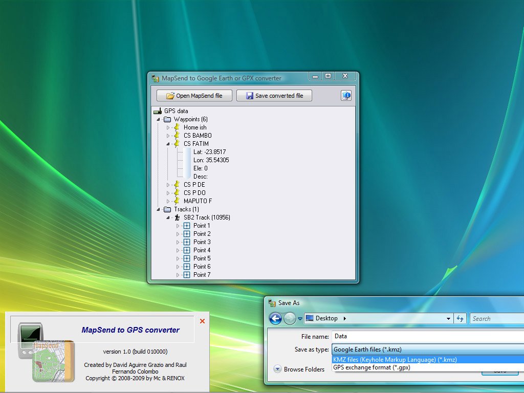
MapSend2GPS
Magellan MapSend (WPT/TRK) → KMZ/GPX. Convert Magellan MapSend files (WPT and TRK) into KMZ or GPX.
Aba2GPS
Palm Desktop (ABA) → KMZ/GPX. Convert Palm Desktop address book (ABA) waypoints into KMZ or GPX.

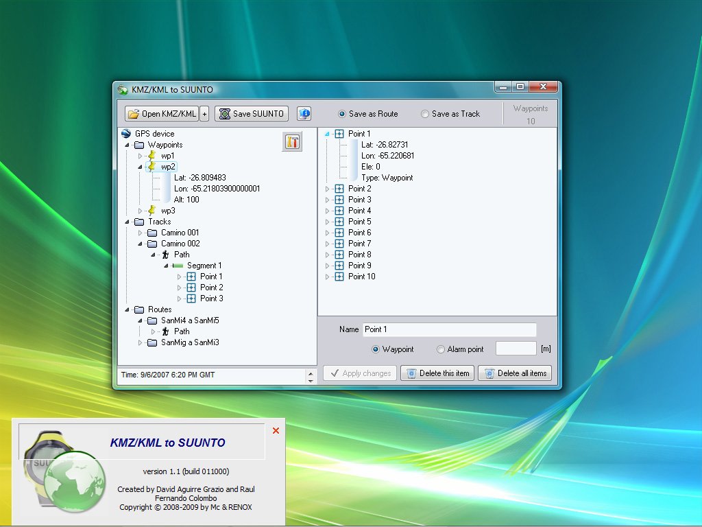
Ge2Suunto
KMZ/KML → SUUNTO SDF. Convert Waypoints, Routes and Tracks from KMZ/KML into SUUNTO (SDF) files for upload into Suunto PC software.
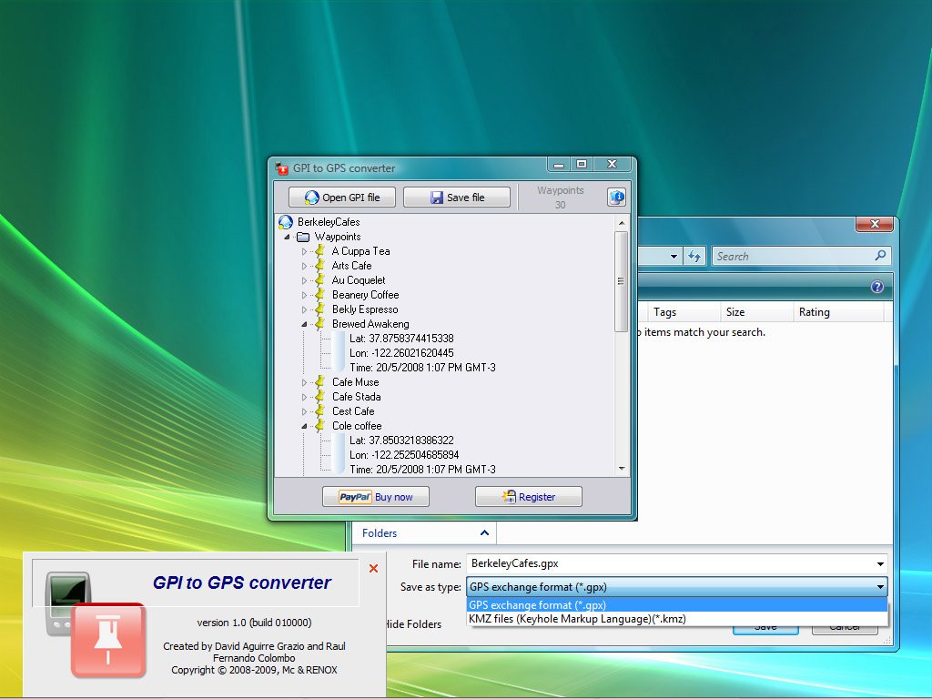
Gpi2Gps
Garmin GPI → KMZ/GPX. Convert Garmin POI Loader files (GPI) into KMZ or GPS-compatible GPX format.
Global Weather 3DOFFLINE
Real-time global weather visualization. Explore worldwide weather on a realistic 3D globe using OpenGL. View hourly-updated cloud layers in different modes, with multiple Earth surface styles (including real-time day/night) and country boundaries.


Sun and Moon world mapFREE
Sun/Moon position over Earth. Shows a world map with the real-time position of the Sun and the Moon over the Earth.

Heading and Distance calculatorFREE
Coordinate navigation utility. Compute heading and distance between two geographic coordinates.

GTerrain - The GameFREE
Multiplayer game based on GTerrain engines. A multiplayer game built on 3D Global Terrain engines. Create network games and play on real-world terrain with GTerrain-based visualization.


Support our developments today!
If you found these applications useful, please help us with a donation. Your support is very important to continue developing and updating these tools.
Donate with PayPalAntivirus: FALSE POSITIVE ALERTS
Some AV scanners do not have properly developed heuristic scanning and produce false positive when scanning files developed in high level languages like Delphi or C. These applications have been successfully installed on millions of computers since 2002 and do not contain any viral infection or trojan code. If any program is blocked, you may need to adjust your AV settings.